Log in
Register
Crisis information sources
CIK Activities
Operational products
Publications
New technologies
Menu
News
Operational products
Activities
Projects
Current projects
Finished projects
New technologies
Publications
About Us
Catalogue
News
20
July 2023
Use of drones and other UAS expected to highly improve disaster response
A COLLARIS workshop examined the use of drones and other UAS (unmanned aerial systems) in disaster response including its benefits but also existing and future obstacles and challenges. The workshop’s overall conclusion was: Once we have solved the problems, we have a bright future when using all these systems, giving us a more effective and correct situational overview.
16
April 2021
Geoinformation Guide: DEM and DSM
New Geoinformation Guide (only in Polish) concerns digital elevation and surface models which are openly accessible for Poland.
21
July 2020
Geoinformation Guide: Copernicus Open Access Hub - update
In today's entry from the "Geoinformation Guide" series, we present the Copernicus Open Access Hub browser designed to download free and open satellite images from the Sentinel mission.
17
July 2020
Geoinformation Guide: Earth Explorer
In today's article from the "Geoinformation Guide" series we will show you how to download free satellite images, eg from the Landsat mission, in a simple and quick way using the Earth Explorer browser.
14
August 2019
Geoinformation Guide: EO Browser - update
We come back with the "Geoinformation Guide" after a longer break. Today's article concerns the functionality of the web application EO Browser.
09
May 2018
Geoinformation Guide: Viewing satellite images of Sentinel-2 and Landsat 8 - update
Today's publication of the “Geoinformation Guide” will introduce us to the secrets of satellite imagery. We will learn how to open satellite images and create color compositions. We will also learn what information is hidden in the filenames of satellite imagery.
04
December 2017
Geoinformation Guide: Sentinel Playground - update
In today's article from the series "Geoinformation Guide" you will get to know the functionality of the web application Sentinel Playground, which enables to visualize imagery coming from the Sentinel-2 satellite.
06
March 2017
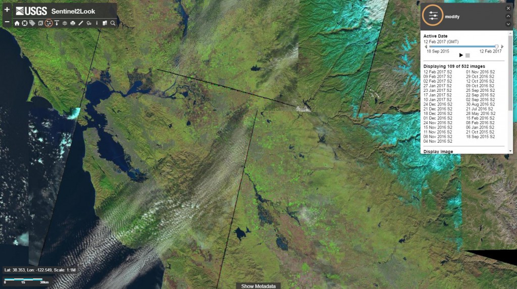
New Sentinel-2 image viewer application
US Geological Survey (USGS) has developed a prototype web application for Sentinel-2 imagery browsing and downloading - Sentinel2Look Viewer.
09
February 2017
Sentinel-2 and Landsat 8 data now available on the Planet Platform
Planet company, the world leader in imaging the Earth with the large constellation of nanosatellites, announced the integration of Sentinel-2 and Landsat 8 data on its Planet Platform. The difficult process of data integration turned out to be a success.
03
February 2017
DigitalGlobe supports crisis management
DigitalGlobe, the leading American provider of high-resolution satellite imagery, announced on its blog the launch of the Open Data Program, which aims to provide satellite data for selected large-scale natural disasters.
16
January 2017
Sentinel-2B getting closer to space
Launching of the Sentinel-2B optical satellite is planned for 7th March. New satellite will join its twin Sentinel-2A satellite which is already in the orbit since June 2015. All of the operational tests that were conducted from 2016, ended up successfully, thanks to which Sentinel-2B has been transported to the spaceport in French Guiana.
08
January 2017
Geoinformation Guide: OpenStreetMap
Today's "Geoinformation Guide" series concerns the global OpenStreetMap project, which allows us to view and retrieve free vector data.
16
December 2016
A new approach in hurricanes monitoring
On 15 December, NASA has launched a constellation of 8 microsatellites – Cyclone Global Navigation Satellite System (CYGNSS). The launch took place from the US Air Force Base at Cape Canaveral. Microsatellites were carried to low-Earth orbit 500 km above the Earth. CYGNSS is funded by NASA and its main developers are the University of Michigan and the Southwest Research Institute (SWRI).
14
November 2016
Geoinformation Guide: Corine Land Cover
Taking a break from issues related to satellite imagery, in today's article from "Geoinformation Guide" series we want to present you free vecor and raster data regarding land cover for the area of Europe. Have you heard about the Corine Land Cover project?
17
October 2016
Geoinformation Guide: LandsatLook Viewer
In today's article from the "Geoinformation Guide" series we will take a closer look at the LandsatLook Viewer web application, which allows for quick view and access to archives of images from the Landsat satellite.
19
September 2016
Geoinformation Guide: Shapefile
In today's article from the "Geoinformation Guide" series we will explain what a file in the Shapefile format is.
05
September 2016
Geoinformation Guide: Google Earth
We begin the publication of a series of guides with practical advice related to the use of geoinformation technologies, particularly in crisis management.
25
August 2016
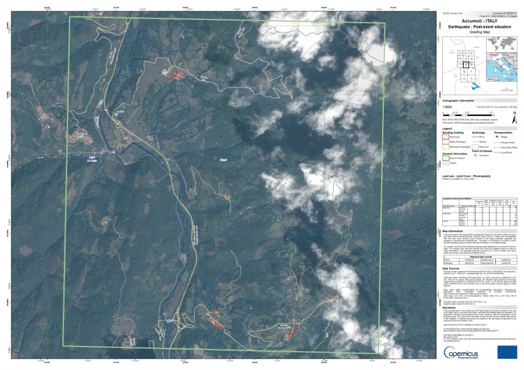
Maps for the earthquake in Italy
A magnitude 6.2 earthquake has struck central Italy (100 km north-east of Rome) very early in the morning on 24th August 2016. Area of damage contains several regions, i.a.: Lazio, Abruzzo, Umbria.The most severe damage The towns of Accumoli, Amatrice, Posta and Arquata del Tronto were among the most severly damaged locations. Several aftershocks struck the region over the next few hours. The most powerful had magnitude 5.5. The final number of victims is not yet known, but it reached almost 250 deaths.
07
March 2016
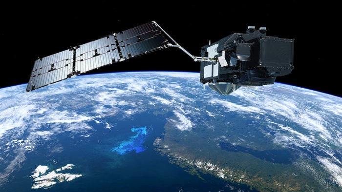
First images from Sentinel-3A
After 2 weeks from successful launch into orbit, Sentinel-3A sent first images of the Earth.
22
February 2016
First satellite from Sentinel-3 series in orbit
Next satellite from the European Earth observation programme Copernicus has been launched into space. This time it is first satellite from Sentinel-3 series.
15
December 2015
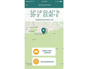
mGOPR, “Mountain IT project”
Since December 2015 an application is available on the market called mGOPR which was created thanks to the cooperation between Mountain Volunteer Search and Rescue (polish Górskie Ochotnicze Pogotowie Ratunkowe - GOPR) and Transition Technologies company within “mountain IT project”.
04
December 2015
ESA has opened access to Sentinel-2A data
Ten serwis wykorzystuje pliki cookies.
Korzystanie z witryny oznacza zgodę na ich zapis lub odczyt wg ustawień przeglądarki.
Log in
The Address e-mail field is required.
The Address e-mail format is invalid.
The Password field is required.
The Password must be at least 7.
Forgot password?
Reset your password
The Address e-mail field is required.
The Address e-mail format is invalid.
Registration
The Name and last name field is required.
The Name and last name must be at least 7.
The Name and last name may not be greater than 50.
The Address e-mail field is required.
The Address e-mail format is invalid.
The Password field is required.
The Password must be at least 7.
Passwords dont match.